Craft Details
Skills Needed:
Share This Craft
Wooden Wall World
Since I knew of the possibilities of a laser cutter and had one in my reach (thx to FREILab) I wanted to build a Wooden Wall World (WWW) behind my home theater screen.
It should be illuminated by addressable LED stripes and I should be able to project live weather data on it with my projector (so I can ask my smart home where something is and it lights up or shows live data of ongoing nuk..weather! Everybody should have his personal tactical map at home!.. 😉 ).
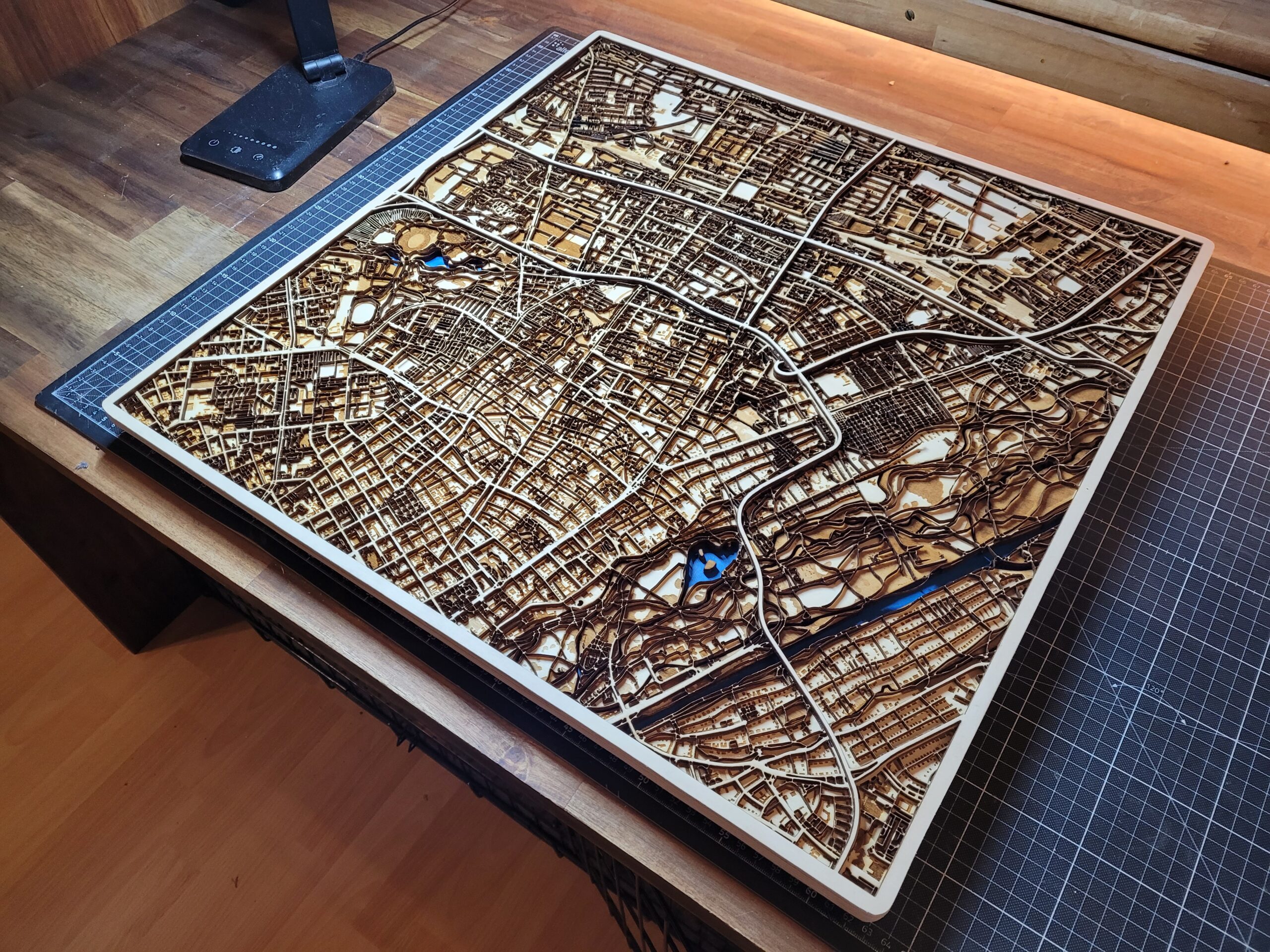
Most time consuming was the gathering and processing of geo-data into usable vector graphics for the laser cutter and deciding how to build it.
First I build a small prototype with old cardboard of one continent.
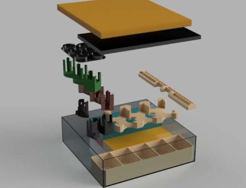
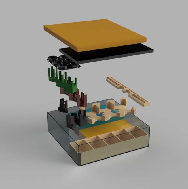
In the end I chose to build hangable (French cleat design) continental plates of 5mm MDF (white on front side) where I can put puzzles of lands on top. This design allows for switching out individual land pieces if I want to try something new (topographic cnc milled pieces with mountains, other materials like metals, laser engraved pieces with vacation destinations…). Bridges between islands are also less exposed and painted white on the cutting edges.
The design also allows for adjusting height and alignment of every continent individually.
Land pieces where cut out of 4mm thick poplar, pine, walnut plywood and cork boards.
At the Antarctica plate I added ice shelf out of light blue acrylic plates (3mm).
Geodata Processing
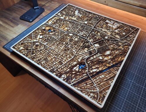
I used data from Natural Earth in scale of 1:10m. Converted the data with QGIS to my desired projection (Patterson, because I wanted to use the nullschool projection overlay by Cameron Beccario) and shifted it, so the antimeridian doesnt cut into the north american continent. Island smaller than ~2mm got ignored.
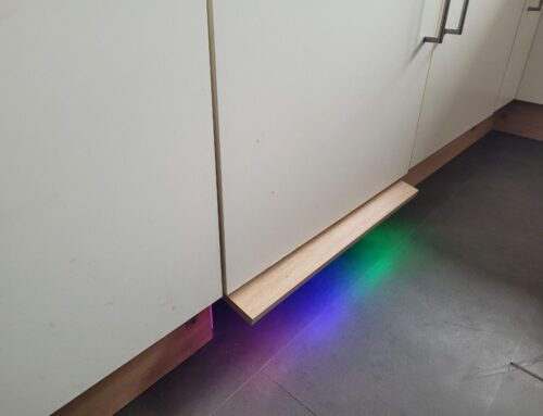
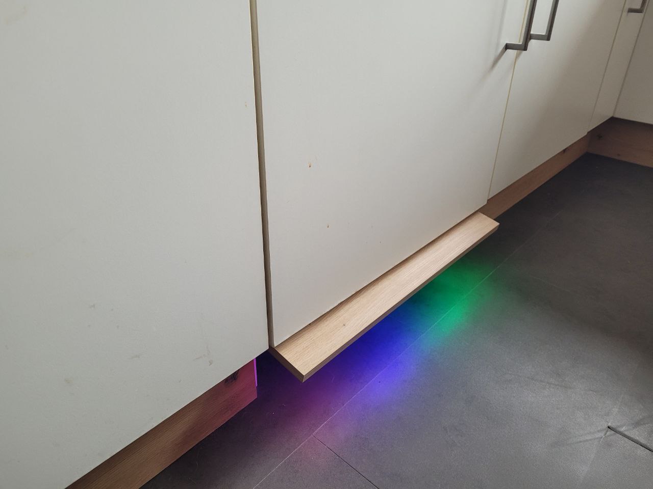
I also added bridges between islands and continents since I wanted the whole map to be ~1cm exposed from the wall. This gives a more elaborated look and also allows LED placement.
The whole size of the map is 2,45 * 1,37 meters. Antarktika with bottom frame for longitude and UTC and endpieces is 3,08 meters wide.
Material
Software
Gallery


Projection overlay
If you don’t use the projection screen it is possible to project a live-map onto the WWW.
Projection is not very perfect on every edge since i use a (atm unavoidable) keystone on my short distance projector. (Expensive 4k projector with 2-axis correction has to wait..)
I use the very nice projection from Cameron Beccario. Check it out at earth.nullschool.net !


Making of


Open Tasks
- Full integration into smart home
- Pins with (red) cord for vacation routes and pictures (optional)
- Details like Ships, a compass card, … (optional)